A long, boat-shaped mound in the mountains of eastern Turkey has drawn renewed attention after a university-led team received permission for its first deep excavation in decades. The site, known as the Durupinar formation, sits on the slopes of Mount Ararat and has long been associated by some with the resting place of Noah’s Ark. The recent fieldwork has reopened a long-standing debate among archaeologists, geologists, and faith-based researchers.
The formation is located in Agri Province, about 18 miles south of the peak of Mount Ararat, which rises more than 5,100 meters. The nearby town of Dogubeyazit sits at roughly 1,900 meters above sea level. The shape of the mound, which resembles the hull of a ship, has made it easy for visitors over the years to imagine a large vessel stranded in the valleys below.
Interest in the site dates back to the 1950s. In 1959, a Turkish army captain named Ilhan Durupinar noticed a boat-like shape while reviewing aerial photographs for a NATO mapping project. The image was published in Life magazine in September 1960, prompting a small American-Turkish expedition to examine the site. The team, which included missionary George Vandeman and photogrammetrist Arthur Brandenberger, spent two days digging and placed small charges to test the ground. They found only soil and rock fragments, and concluded the formation was a natural feature.
Despite that early assessment, the shape of the mound continued to attract attention. The formation measures between 515 and 540 feet in length, depending on how its edges are defined. The Book of Genesis describes the ark as 300 cubits long. Using a common cubit of about 18 inches, that equals roughly 450 feet. Using a royal Egyptian cubit of about 20.6 inches, the length comes to approximately 515 feet, close to the mound’s size. That resemblance has driven much of the popular interest, though the cubit varied between cultures, allowing some flexibility in the comparison.
Geologists have long offered a simpler explanation. The mound resembles forms naturally shaped by water, wind, and ice. Glacial hills called drumlins, desert ridges called yardangs, and mudflows that settle in teardrop shapes all produce elongated forms. Turkish air force images show similar boat-shaped patterns in mud on nearby Mount Ararat itself.
In 1977, Ron Wyatt, an American nurse anesthetist, visited the site and declared it a petrified ship. He was joined by David Fasold, a former merchant seaman who studied pierced stones in the nearby village of Kazan and claimed they were ancient maritime anchors. In 1987, the Turkish government designated the area a national park, a move critics considered premature. In a 1996 paper co-authored with geologist Lorenz Collins, Fasold concluded that the mound was a folded sedimentary structure, not a ship, and retracted his earlier claims.
The search for the ark has a long history. The Jewish historian Josephus wrote in the first century that remains of the vessel were still shown in Armenia. The Babylonian priest Berossus, writing three centuries earlier, claimed pilgrims scraped bitumen from wreckage in the mountains of the Kurds and carried it as an amulet. Marco Polo wrote around 1300 that the ark rested on a great mountain in Armenia, though snow made it unclimbable. The peak was finally climbed in 1829 by Friedrich Parrot. Later expeditions produced claims of wood finds, though none were reliably confirmed.
The Durupinar site gained particular attention because it was low-lying, accessible, and visible from a road, unlike the high slopes of Mount Ararat. A visitor center now operates there, and the site receives a steady flow of pilgrims and tourists.
Several waves of investigation have tested the mound. In 1987 and 1988, a team led by geophysicist John Baumgardner and geologist Salih Bayraktutan of Ataturk University used magnetometry, radar, and seismic lines. The radar specialist on the team, Tom Fenner, spent more than a day trying to reproduce earlier radar images and could not. The team drilled four cores to a depth of about 10 meters and reported bedrock at six to seven meters, with limestone containing microfossils and a fault running through the middle of the formation.
A second wave began around 2019, when a team linked to television production and the American-based Noah’s Ark Scans group surveyed the mound with dense radar grids and drone mapping. Between 2021 and 2024, additional soil studies involved Turkish universities, Istanbul Technical University, and Andrews University.
The 2026 season began in late June and ran through September. It was directed by Professor Sincer Atila, an archaeologist at Sivas Cumhuriyet University. About 20 researchers and students took part, alongside the Noah’s Ark Scans team led by Andrew Jones and geotechnical engineer Cosgrove Baktar, who provided a specialized radar system. A public fundraising campaign sought around $600,000 to cover excavation costs. The work required a permit from the Turkish Ministry of Culture and Tourism, and it included the first deep core drilling at the site.
The two sides have differed in their public statements. Jones has said he believes the mound is the ark. The university side has described all findings as preliminary. Both sides agree that radar images were the starting point for the recent interest.
Ground-penetrating radar is a well-established tool in archaeology. It has been used to map buried streets at the Roman town of Valeriy Novi and to reveal hidden features around Stonehenge. But the method has limits. Low-frequency antennas reach deeper but blur details, while high-frequency antennas trade depth for resolution. In wet, clay-rich ground, radar signals fade within a meter or two. The apparent depth of a feature depends on assumptions about how fast the signal travels through the soil, which varies with moisture.
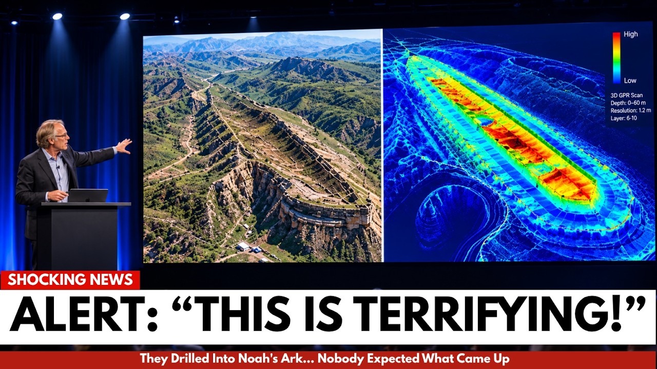
The radar readings at Durupinar have produced striking images. The team reports long parallel bands running along the mound, a central corridor over 200 feet long, rectangular pockets arranged on either side, and curved bands beneath the edge described as ribs. Depths are reported between 20 and 40 feet. Some interpret these as structural elements, while geologists point out that sedimentary layers naturally fracture along joints that often intersect at near-right angles, producing rectangular block patterns. The human tendency to see recognizable shapes in random patterns is well known and is referred to as pareidolia.
Soil chemistry has also drawn attention. Researchers involved in the project report that samples from 2024 contained roughly three times more organic material inside the boat-shaped area than in the surrounding hills. Potassium levels were said to be about 40 percent higher, and acidity was higher as well. Some samples contained clay with what the team interpreted as possible marine sediment and shell fragments.
While the decomposition of wood would enrich soil with carbon and potassium, other factors can produce the same result. Slower water flow encourages dense plant growth, and leaves, roots, and grasses raise carbon, potassium, and acidity without any structure being present. The local limestone is rich in microscopic marine shells, so their presence in soil does not prove the site was submerged. Researchers on the project themselves caution that high organic content does not confirm the existence of a wooden structure.
Some popular accounts describe chambers revealed by sonar and thermal cameras. Sonar requires water to transmit sound and cannot map a dry hillside. Thermal cameras detect infrared energy from surfaces and cannot see through soil. No credible report from the 2026 season describes metal signals or hull fragments. Those details appear only in dramatized retellings.
The actual excavation results were more modest. Drilling reached 18 meters in one location and between five and eight meters elsewhere. Jones said the drill encountered soil rather than solid rock, which he described as rich black dirt. The group also reported the drill breaking on a very hard layer at about 13 feet and encountering voids. The university side mentioned approximately 1,000 soil samples from about 150 locations and sherds of pottery. The two groups give different totals, a reminder that published reports are still pending.
Supporters say finding soil where bedrock should be contradicts the idea that the mound is a natural rock formation. Skeptics note that the site is composed of loose clay and landslide debris, which is what earlier surveys described. A thick mudflow can form a boat-shaped mound without any structure inside. The 1988 team found bedrock at only five or six meters in some holes, showing how much results depend on where drilling happens. The hard layer that broke the drill could be a large rock, a cemented band, or a limestone slab. The void could be a gap in loose debris or a decayed root channel. None of these features have been identified as parts of a chamber. No ancient wood has been identified at the site.
Radiocarbon dating of organic material from the formation has given dates between 3,500 and 5,000 years ago, which overlaps with the period of early Mesopotamian cities and flood narratives from that region. But radiocarbon dating measures when a plant stopped living, not when a structure was built. Mixed soil can contain carbon from multiple ages, and calibration adds further uncertainty. A landslide that swept old trees and plants downhill would produce old dates without involving any vessel.
Some researchers suggest a middle interpretation: an ancient settlement, storage facility, or ceremonial platform buried by a mudflow. This could explain regular geometry without invoking a flood legend. The region has been inhabited for thousands of years. The Kura-Arraxes culture, known for its black polished pottery, flourished there from about 3400 to 2000 BCE, followed by the Kingdom of Urartu. Pottery found on a hillside near Mount Ararat is not significant unless it is extracted from inside a buried structure and dated.
The region’s geology is genuinely active. Mount Ararat sits near the collision zone of the Arabian and Eurasian plates. A November 1976 earthquake at Caldiran killed several thousand people. An October 2011 quake near Van killed more than 600. The mountain itself has a documented history of landslides. In 1840, an earthquake and massive landslide buried the village of Akori and a nearby monastery, killing thousands. A sudden mudflow in an earthquake-prone area can bury a slope without requiring a global flood.
The next steps are public. In late September, the project’s deputy director told Newsweek that the team had not identified any material as ancient wood or proved its age. Laboratory results are expected during the winter, with the first full publication planned for 2027. Baktar’s final radar report is due in late November, and Jones was scheduled to present a paper at a conference in mid-October.
What would resolve the question is straightforward: preserved wood in samples with visible cellular structure and radiocarbon dating taken from the wood itself, signs of human tool marks, joints, or fasteners, and residues identifiable as bitumen, the coating mentioned in the biblical text. The wood would need to be examined by independent laboratories and published for review.
What is currently known is limited. The mound is real, roughly 515 to 540 feet long, in eastern Turkey. The 2026 season was the most thorough investigation in the site’s history. Radar images show features that some interpret as structure. Soil inside the formation differs from soil outside. Drill samples found soil where some expected rock. Pottery was collected but has not been dated.
What is not known is whether any of this relates to human construction. No wood, no tool marks, no joinery, no bitumen have been found. No results from 2026 have been published in peer-reviewed journals. The site has a documented history of natural explanations, and the current evidence does not yet answer the question of what the formation actually is.






