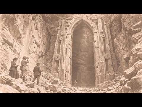
In the autumn of 1900, deep inside a gold mine in northern Georgia, a crew heard a hollow ring behind the rock face. They set a small charge and broke through—not into a cave, but into a corridor. The walls were dressed stone, the joints as fine as a hair. At the end stood a true half-circle archway, sixteen feet high. Nobody builds a sixteen-foot doorway for a man. And the Cherokee, who had never seen that arch, already had a name for it.
That is where this story begins—a story of two records, separated by nine years and six hundred miles, each unaware of the other. Before we can understand what was found behind the stone, we need to understand the mine itself, and the men who measured it, and the old Cherokee who told of a doorway at the head of a creek above Delonaga—a threshold a man once stepped across and never came back from.
Today, Delonaga is a small town an hour north of Atlanta, at the foot of the Blue Ridge Mountains. East of town runs a narrow, cold stream called Yahula Creek. In this story, the name of that creek matters. The town’s name comes from a Cherokee word meaning yellow—the color of gold. Because these ridges are where America’s first great gold rush happened, twenty years before California.
In 1829, gold turned up in the streams. Within a few years, tens of thousands of people poured into the mountains. Creeks were torn apart by pans, sluices, and pits. In 1838, the federal government opened a mint in the town. The gold coins struck there carried a small letter D. Before the Civil War shut it down, that mint turned out more than six million dollars in gold.
That same year, the people who owned this land were driven out of it. The Cherokee had lived in these mountains for centuries. Their valleys were full of towns, fields, and council houses. Once gold was found, the state of Georgia gave Cherokee land away to white settlers by lottery. In 1838, the army came. Thousands of Cherokee were rounded up into camps and marched west to what is now Oklahoma. That march is called the Trail of Tears.
But the Cherokee did not disappear. Today, the Cherokee Nation and the United Keetoowah Band live in Oklahoma. The Eastern Band of Cherokee Indians lives in the mountains of North Carolina. And the stories they tell about these mountains went west with them into exile.
By the 1850s, the gold rush had burned out. The easy gold was gone. What remained was locked inside hard quartz veins and could not be taken without breaking the rock. In 1899, a group of investors came back to Delonaga. They bought roughly 7,000 acres and founded the Delonaga Consolidated Gold Mining Company with five million dollars in capital. They built the largest gold plant ever raised east of the Mississippi—a four-story mill with 120 stamps inside, each weighing 840 pounds. It could crush 600 tons of rock a day. Tunnels hundreds of feet long were driven into the mountain.
The rock in these mountains does not give itself up easily. The Delonaga gold belt is made of dark schist and gneiss, crushed and folded over millions of years. Gold lies in white quartz veins that cut through that dark rock. A miner follows those veins. When a vein disappears, he works blind through the rock, listening to it, watching its color. That detail matters because the stone found inside the mountain looked nothing like this rock.
To do the work, the company brought in men from the west—engineers, surveyors, and foremen trained in the hard rock mines of California and Colorado. The first record in this story belongs to one of them. His name was Nathaniel Pel.
He was born in 1859 in the gold camps of Grass Valley, California. His father had worked in a quartz mill. At seventeen, Pel went to work as an apprentice on a survey crew, and he spent the next twenty-five years inside mountains, measuring angles and distances by lantern light. In 1899, at forty, he came to Georgia with the engineers the Consolidated brought east. People who knew him later described him as quiet, exact, and incurious. He never married. In the evenings, he read star charts and wrote everything down.
Pel’s job was to survey every tunnel the company drove into the mountain and put it on a map. The bearing, the grade, and the length of each tunnel, the thickness of each vein. He kept it all in pencil in a pocket-sized field book bound in leather—a number, a short description, and when needed, a small sketch. No commentary.
In October 1900, the company was driving its number four adit into the ridge above Yahula Creek. The tunnel entered the mountainside on the level and followed a quartz vein westward about 140 feet beneath the surface. The crew drilled by hand, blasted with black powder, and advanced about three feet a day. On the morning of Tuesday, October 16th, they were 310 feet in from the portal.
The crew boss was Ant Satderfield, a Lumpkin County man. He had four men under him that morning. Two drillers, a mucker to shovel the broken rock into the car, and a boy who kept the candles lit. Old miners had a habit of sounding the face before every blast. A man strikes it with a hammer. Solid rock answers short, dry, and dead. Satfield struck, and the sound hung in the air. He struck again and heard the same sound—deep, hollow, ringing somewhere behind the rock.
He stopped the work and sent word to the surface. Pel was at the portal running surface elevations. He went in with a lantern, a leveling rod, and his field book. He ran his own hands over the face. He heard what Satfield had heard. The first line in his book read: “310 ft. Face sounds hollow, not a water pocket, volume large.”
That afternoon they set a small charge. When the dust cleared, a ragged hole about four feet across had opened in the face. Behind it was darkness. The lantern light fell away downward. The floor of whatever they had broken into lay six feet below the floor of the tunnel.
Pel went first. That was his job. He would decide what they were dealing with before anyone widened the hole. Two men took him by the arms and lowered him through. His boots touched stone. Years later, the shift foreman, Wy Chastain, would describe that moment. Pel went down and said nothing. A minute passed, then two. The men above called to him, and Pel did not answer. At last he said one sentence: “Send down another lantern.”
Chastain carried that sentence for thirty-six years because the lantern light was coming back off a wall of cut stone. The second line in Pel’s book was shorter: “Walls dressed.”
Pel took the second lantern and walked. The corridor ran dead straight. The walls looked like a single solid mass until the lantern came close and the light raked across the surface. Only then did the joints appear. Vertical joints about every four feet. Horizontal courses eighteen inches high. Clean squared blocks the kind found on the front of a church. The floor was paved in the same pale gray stone.
At the end of the corridor, the lantern light struck a curve. Pel had seen the arch from the far end of the passage, but as he later told Chastain, his eye only accepted it once he had walked right up to its foot. He looked up and found the keystone where his lantern light barely reached. Twenty-five years of habit let him judge the height by eye. Then he extended his rod, fitted its three sections together, and measured.
The third line in his book held the number this entire story rests on: “Arch true half round keystone inside height to underside of key 16 ft 0 in.” Pel did not round to the half foot. He did not round to the inch. He wrote zero.
And at the bottom of that same page in pencil, there was a fourth line that had clearly been added later. That line would one day persuade the woman who found this file seventy years on to give the last twenty years of her life to this arch. The fourth line was a single sentence, and it ended with a question mark. In twenty-five years of Pel’s field books, there is no other question mark anywhere. “Sill worn hollow at center two and a half in not water feet.”
We will come back to that. First the arch itself.
For three days, Pel barely left the corridor. He filled four pages of his book and made three pencil drawings. The corridor measured twenty-four feet from the point where the tunnel broke in, six feet eight inches wide, nine feet from floor to ceiling—the same from end to end. The ceiling was flat, and long lintels, each a single stone, spanned it from wall to wall.
About the stone itself, Pel wrote three things. Its color: pale gray, nearly the color of ash, fine grained, nothing like the dark schist of the mountain. Its surface: smooth to the palm, no chisel marks, no wear, no water stains. And its joints: he tried to push the iron tip of his rod into every joint from the springing to the crown. The tip would not go in anywhere. No mortar. The stones simply sat against one another.
The arch was a true half circle, eleven feet wide inside, sixteen feet high. The jams rose in nine courses, each the same height. The curve was made of seventeen stones, and the keystone at the crown carried three rings carved one inside another. Set into each jam were two round stone discs, each about three feet across, a raised boss at the center pierced through. Between the discs, a narrow niche seven feet tall, fourteen inches wide, two feet deep. Both were empty, and their floors were as smooth as the walls.
Last, the sill—one single stone, eleven feet long, three feet deep, a foot thick. Pel worked out its volume and wrote a weight in the margin: about nine tons. On no face of that stone was there a Lewis hole, a pry mark, or a notch for lifting. Nine tons of stone had been set down 140 feet underground without leaving a trace.
Beyond the arch was darkness. Pel held his lantern out under it. The light fell on a floor, and the floor dropped away. He lowered a lantern on a rope. The rope went taut. The lantern swung. The light flickered off faces of stone. Pel did not measure what lay beyond. But he made his third drawing—a plan, looking straight down the tunnel, the corridor, the arch, and beside it a bearing he had taken with his compass. The axis of the corridor pointed 22 degrees west of north. From inside the mountain, the archway opened toward the upper valley of Yahula Creek.
The last two lines of that section read: “By arch floor falls away. Air from beyond warm.” 140 feet below the surface in October. Warm air was coming out of the mountain. Pel did not explain it. He wrote it down and left it there.
On the fourth day, the company’s superintendent came down. J.H. Radcliffe had been sent south from the head office. He stood in front of the arch for about half an hour, studied the keystone, looked over the discs, and reached into the niches. Then he asked Pel one question. “Is there gold in it?” No, said Pel. Radcliffe nodded.
Then he offered an explanation—that this was some forgotten gold-rush tunnel, a water passage or storeroom lined with stone by men whose records were long gone. It was a sensible answer, and to be fair to it, it has to be heard in full. But it leaves a few things unexplained. Gold rush miners held up their tunnels with timber. Stone lining was expensive and slow. Nobody faced a corridor with no gold in it in dressed stone like the front of a church. The explanation also does not say how that stone reached 140 feet underground into a corridor with no entrance from outside—other than the wall the tunnel had just broken through. And above all, it does not explain the arch. A water passage has no use for a sixteen-foot arch. A storeroom has no use for stone discs set into its jams or for empty niches seven feet tall. And no abandoned mine tunnel ever saw enough feet to wear its sill two and a half inches deep.
Radcliffe did not argue these points. He did not need to. His question was never what it was. His question was how long it would hold up the work. On October 22nd, Pel turned in his official report and recommended that work in that section stop until an archaeological examination had been made. The same day, he wrote a separate letter of his own to the state geologist in Atlanta. Radcliffe’s answer came a week later. The vein would be followed north, away from the corridor. And the hole where the tunnel broke into the corridor would be sealed to prevent accidents.
The crew spiked a wall of heavy planks across the opening. They packed the space behind it with waste rock. Chastain remembered that when the last shovelful went in, nobody said a word. No archaeological examination was ever requested.
While those planks were being spiked into place, the name of the arch was already written in a notebook six hundred miles to the west. The third record is not written. It is spoken, and it is the oldest record in this story. A name can be misfiled in a county ledger. It cannot be misfiled in the mouth of a living person.
In the spring of 1891, a young ethnologist sat down at a table in Tahlequah, capital of the Cherokee Nation, across from a man of eighty-five. The ethnologist was James Mooney. The man was James Wafford, born in 1806 in the old Cherokee country. In 1824, at eighteen, the Cherokee Nation sent him into the mountains as a census taker. His district was the upper Hiawassee and the valleys of the Nottely and the Toccoa—the ridges north of Delonaga. That year, Wafford rode or walked every valley, every trail, every named place. And everywhere he went, he listened to what the old people told him.
Fourteen years later, in 1838, he was one of the two men leading one of the largest detachments that marched west out of those mountains. Mooney wrote this about him: “His mind was still clear and his memory keen.”
Part of what Wafford told him was published nine years later in Mooney’s great work, Myths of the Cherokee. And inside that book, page after page, there is a people who live inside the mountains. The Cherokee called them the Nunnehi, the people who live anywhere. They had great council houses in the high mountains on the bald summits where no trees grow. Those houses were inside the mountains. Mooney recorded where three of them stood. One inside Pilot Knob in North Carolina, one beneath the old Nikwasi mound, and one in Georgia at the head of the Nottely River beneath Blood Mountain—in the very valley where Wafford had taken his census.
They said the Nunnehi were invisible. When they chose to be seen, they looked and spoke like any other people of those mountains. They would find travelers lost in the mountains, take them to their homes beneath the mountain, care for them until they were rested, and then guide them home. They said that once the whole population of a town called Kanasta moved into Pilot Knob. Two guides led them in through an opening in the side of the rock, one that opened out like a great door. Inside, houses stood in two long rows running east to west. The one man who came back out turned around to look. He saw no opening, only solid rock.
And there is a small sentence in that story. Even after the whole town had settled in, there were still many empty houses inside the mountain, ready, waiting for whoever would come next.
These stories are still told today in the mountains of North Carolina, in the Big Cove community of the Eastern Band, in Cherokee homes in Oklahoma. Not as fairy tales, as place names, as creek names, as a hill a grandfather points out to a grandchild.
And one story in Mooney’s book belongs by name to Delonaga. In Cherokee, Yahula Creek is Yahulai—Yahula’s place. They said that long before the Revolution, Yahula was a prosperous trader in horses. The bells on his ponies’ necks could be heard on every mountain trail. After a great hunt, he did not come home. His family mourned him as dead. Then one evening while they sat at supper, he walked in through the door and sat down among them. He told them he had been lost in the mountains, that the Nunnehi had found him and taken him to their town. He said he had to stay with them now, and he stood up, and the moment he stepped out the door, he vanished.
After that, he came back often. They would see him come in. While he sat and talked, he was himself again. But the instant he crossed the threshold, even with a hundred eyes on him, he was gone.
Mooney gives one more detail. At the head of the creek, about ten miles above present-day Delonaga, there was a small square enclosure of uncut stone. It had no roof. It had no entrance. The Cherokee said that was where Yahula lived.
That is where the published part ends. But in Mooney’s 1891 Tahlequah notebook, there is a page that was never printed. On that page, Wafford repeats something the old people at Nottely told him in 1824. The stone enclosure was not Yahula’s door. A house without a door was only there to mark the place. The door itself was lower down, where the yellow is under the ground. And the old people said two things about that door. Its threshold was worn by the feet of those who came and went, and the door had not been made to their measure.
The Cherokee had already given that place a name. Yahulai—the place of the man who crossed the threshold and did not come back. In the margin of that page, Mooney drew a small shape in pencil: a half circle, and on either side of it, one above the other, two small rings. Mooney left that page out of the book. He never wrote down why.
And in Georgia, as Pel drew two discs on either side of a half circle, he had no idea that page existed.
Now the two records have to be set side by side. Two records separated by nine years, six hundred miles, and not a single letter between them. Pel’s field book: sill worn hollow at center two and a half inches, not water, feet. Wafford’s elders: its threshold was worn by the feet of those who came and went. Pel’s field book: air from beyond warm. The Nottely story: warm vapor rising from the ground, a fire under the mountain. Pel’s compass: the corridor points twenty-two degrees west of north toward the upper valley of the Yahula. Mooney’s book: at the head of the Yahula, ten miles up, a stone enclosure with no entrance. Pel’s rod: sixteen feet, zero inches. Wafford’s elders: the door was not made to their measure.
On the surface, a house with no door. 140 feet down, a door with no house. Pel’s drawing: a half circle, two discs on each side, four in all. Mooney’s margin: a half circle, two rings on each side, four in all. And the story of Pilot Knob: houses inside the mountain, still ready, waiting for whoever comes.
No one had told Pel about Yahula. No one had shown Wafford the Consolidated number four adit. Wafford was dead before that tunnel was ever driven. None of these records states a conclusion. Pel only measured. Wafford only told. And the gap between them is the story itself.
On the last evening before the seal went in, Wy Chastain went down into the corridor alone one more time. Thirty-six years later, when he told a reporter about it, he lowered his voice. He left his lantern at the near end of the corridor beneath the hole the tunnel had broken through. In the dark, trailing one hand along the wall, he walked twenty-four feet. He stopped in front of the arch. He did not step onto the sill. He knelt, and he laid his palm in the hollow at the center of the threshold stone.
The stone was warm. The walls were cold, the floor was cold, the jams were cold. Only the center of the sill under his palm was warm, like a chair someone has just stood up from. 140 feet underground at the end of October. There was no reason for that stone to be warm. Chastain drew back his hand, picked up his lantern, and climbed out. The next morning, the plank wall went up.
Chastain told the reporter one more thing. The winter after the wall went in, two men working the night shift at the end of the tunnel said they heard a tapping from behind the planks. Faint and regular. It went on for a few minutes, then stopped. Chastain put it down to water dripping through the rock. The men did not. Both asked to be moved to another tunnel before spring.
In Mooney’s story of Yahula, the sounds that travelers heard along the creek at night carried a rhythm, too. A song, the crack of a whip, and the steady ringing of horse bells.
But that arch would be opened one more time. Thirty-five years later, another man with another lamp would look past the threshold. The fourth record is the record of the man who went back.
The Consolidated collapsed in 1906. The five-million-dollar plant never pulled the gold it had been promised out of these mountains. The mill went quiet. The lower workings flooded. Brush grew over the portal of the number four adit. Deep inside, in the dark, the plank wall slowly rotted under the weight of the waste rock.
Then on January 31st, 1934, a stroke of a pen in Washington changed the arithmetic of these mountains. Under the Gold Reserve Act, the federal price of gold went from twenty dollars and sixty-seven cents an ounce to thirty-five dollars. Overnight, every small mine that had shut its doors was worth a second look. Men came back to the ridges of North Georgia. One of them was Roy Ledford.
Born in Hall County in 1901, he had graduated from the Georgia School of Technology in Atlanta as a mining engineer. In 1935, at thirty-four, he was examining the old Consolidated lands for a small company formed by three partners from Gainesville. He had copies of the company’s old maps—the maps Pel had drawn—and on one of them, at the 310-foot mark of the number four adit, there was a small rectangle in pencil with one word beside it: sealed.
In March 1935, Ledford went in with two men. The plank wall had given way. Part of the waste rock had slumped into the tunnel. They cleared the hole in a single day. The corridor was there exactly as Pel had left it thirty-five years before. Not a stone had fallen, not a joint had opened.
Ledford measured it. He had Pel’s four typed pages with him, copied from the state files in Atlanta, and he checked every figure against them as he went. His figures matched Pel’s inch for inch. The corridor, twenty-four feet. The arch, eleven feet wide inside, sixteen feet to the underside of the keystone. Ledford also slid a pencil into the holes at the centers of the discs. It went in nine inches and touched bottom. Under the tip of the pencil, the inside of the hole was polished like glass.
But Ledford did two things Pel had not done. First, he had brought a thermometer, and he read it every ten feet as he walked in. In the tunnel, as everywhere inside the mountain, the air stood at fifty-four degrees Fahrenheit. In the corridor, fifty-six. Beneath the arch, over the sill, sixty-four. Ten degrees, 140 feet underground, with no fire anywhere.
Second, he crossed the threshold. In his report, he gave it a single sentence. Beyond the arch, seven steps of the same pale gray stone led downward. Each step was twenty-two inches high and thirty inches deep. Twenty-two inches—nearly three times the rise of a step a person climbs comfortably.
Ledford went down those steps, bracing himself with his hands. He held his lamp to each one. The center of every step, like the sill, was worn into a shallow hollow. The top step most of all, the bottom step least. The light of his carbide lamp fell across a wide floor below, but did not reach the far wall. To his right and to his left, along the walls, as far as the light would go, the same round stone discs ran in a row. Ledford counted eleven. Then the light ran out. He went no further. His report does not say why.
Before he climbed out, he took three photographs of the arch with a magnesium flash camera. They are the only photographs of the arch known to this story. That year, the partnership did not find the gold it was hoping for. In 1937, it broke up. Before he left, Ledford built a new wall of concrete block across the hole into the corridor. Before the mortar set, he scratched a date into the middle of it with the point of a nail: 1935.
In the Second World War, Ledford built bridges with the Army Corps of Engineers. Afterward, he worked for a road company in Gainesville, and he died there in 1974. His family says he never talked about the tunnel except once. In a letter written in 1981, his daughter described how one evening at supper, for no reason at all, her father said a single sentence. “Those steps weren’t made for going down. They were made for coming up.” His daughter did not ask what he meant. Ledford did not explain.
News of the reopening spread fast in Delonaga. In the summer of 1936, a reporter from the local paper, the Delonaga Nugget, knocked on a door at the edge of town. It belonged to Wy Chastain, sixty-eight years old. That day, for the first time in thirty-six years, Chastain told a stranger about the number four adit—Pel’s words, “Send down another lantern,” the warmth of the sill. And when the reporter asked why he had never spoken of it before, he answered: “A man who told a thing like that would never get hired in a mine again. So we didn’t tell it.”
The interview ran on an inside page, half a column long. The headline read: Old Miner Recalls Stone Room.
But Ledford’s descent was not the only echo in this story. The fifth record comes from outside the mountain. The arch does not stand alone. North and west of Delonaga, along the same mountain chain, there are places the Cherokee linked to another people or to the people inside the mountain. Each one has a name, a date, a measurement.
The first is Track Rock Gap, a narrow pass in Union County, about five miles east of Blairsville, west of Blood Mountain. There the faces of several soft soapstone boulders are covered in hundreds of carved marks—circles, rings inside rings, footprints. The Cherokee called the place Datsunalasgunyi. In the Pilot Knob story Mooney recorded, the people inside the mountain say one sentence in their own voice: “Others of us live at Datsunalasgunyi.”
The second is Nikwasi. In the center of the town of Franklin, North Carolina, on the bank of the Little Tennessee River, stands a low earthen mound covered in grass. A council house of a great Cherokee town once stood on top of it. In the story Mooney recorded, the Nunnehi had their own council house underneath it, and when the town came under attack, Nunnehi warriors poured out of the mound and saved it. The mound is still there. In 2019, the town of Franklin handed its ownership to a nonprofit in which the Eastern Band of Cherokee is a partner.
The third is Fort Mountain, a summit in Murray County at the southwestern end of the Cohutta Mountains. Across the top runs a stone wall 855 feet long, zigzagging in places, six feet high. Archaeologists date it to somewhere between 500 and 1500 AD. Who built it and why is still argued. In 1797, the Philadelphia naturalist Benjamin Smith Barton recorded a tradition that when the Cherokee came into this country, they found another people already here—a people who could not see in daylight. The tradition gives the wall on Fort Mountain to them.
And the fourth is very far away. At Saqqara in Egypt around 2340 BC, a tomb of thirty-three rooms was built for Mehu, vizier to the Pharaoh Teti. In its innermost hall, a door is carved into the wall—a complete door with jambs, a lintel, and a threshold, but it does not open. There is no room behind it. Egyptologists call it a false door. To the Egyptians, that door was not for the living. The ka of the dead, his life force, passed back and forth through it between this world and the other side. Offerings were laid in front of its threshold, and out of Mehu’s false door, even today, a life-sized statue of Mehu is stepping forward, one foot already across the threshold.
The Egyptians wrote down plainly who their door was made for. The Cherokee did not write down who the door on the Yahula was for. They told it. Pel wrote down only its measurements. No record says who it was made for.
The sixth record is the last file, and it is the heaviest, because every document in this story was cataloged once before it disappeared.
Pel’s letter to Yates, with inked copies of his three drawings, was received in Atlanta in November 1900. It was given a receipt number. No reply was written. The letter went into a folder labeled Lumpkin County Old Workings, alongside complaints about abandoned tunnels left over from the gold rush. When the company failed in 1906, its engineering records, maps, and field books were handed to the Geological Survey of Georgia to become part of the state’s mine records. Pel’s leather field book was among them. Pel left Georgia the following year. He died in Leadville, Colorado, in 1919. He never came back to ask about his book.
In 1909, the second major report on the gold deposits of Georgia was published—Bulletin 19. Its author was the assistant state geologist, S.P. Jones. In the section on the Consolidated property, there is a single sentence: “An old walled passage reported in 1900 in the number four adit has not been examined. The adit having been closed.” One sentence. Then the report moves on to the next mine.
In 1924, under state geologist S.W. McCallie, a clerk named Ora Poteet was preparing summaries of old mine surveys. She typed four pages out of Pel’s field book—the measurements, the descriptions, the four lines. She left out his personal notes, his weather entries, and his drawings. Today, the only source for Pel’s words is those four typed pages.
In 1937, the Geological Survey of Georgia was reorganized as the Department of Mines, Mining, and Geology. The archives were moved. Pel’s field book was not on the moving list. It has not been seen since.
And then Ledford’s three photographs. Ledford had sent them to Atlanta in the autumn of 1935 with his report. The accession ledger records it: Consolidated property, number four adit, report, 3 photographs. Three years later, when a librarian opened that folder, the report was there. Its four pages were there. Pel’s letter and his three drawings were there. And there was a brown envelope with three photographs written across it in ink. The envelope was empty.
No one stole the photographs. No one hid them. Maybe they were taken out to be copied and never put back. Maybe they slipped into another folder. The record says only this: the envelope was there. The photographs were not.
The librarian’s name was Frances Hail. She was born in Rabun County in 1916. From 1946 to 1978, she worked in the library of North Georgia College in Delonaga. She was not an archaeologist, and she said so at every opportunity. Her gift was for finding a thing inside the records and testing whether it agreed with another record.
In 1968, the college was having old issues of the Delonaga Nugget put on microfilm. Checking the reels, Hail came across Chastain’s interview on an inside page from 1936. Old Miner Recalls Stone Room. For three years, she traced every name in it. In the spring of 1971, she went to Atlanta. The Department of Mines, Mining, and Geology stood on the edge of a sweeping reorganization of state government. Within a year, it would be dissolved and folded into the new Department of Natural Resources. The folders in the basement were being reviewed to decide which to throw away. Hail found the Lumpkin County Old Workings folder inside a carton. It carried an inventory number that matched no catalog. She photocopied every page and put the folder back.
But it would take her eight more years to find the other half. In 1979, Hail wrote to the National Anthropological Archives at the Smithsonian in Washington. She asked for every page in Mooney’s notes where the name Yahula appeared. The answer came a year later—a photocopy of one page. That page was not filed with Mooney’s Cherokee Myths. It sat in a folder labeled Western Cherokee, geographic names, miscellaneous, among notes on the pronunciation of place names. For ninety years, it had been cataloged as a vocabulary sheet. The archivist’s letter was short. No other page mentioning Yahula had been found. On the back of the sheet, in Mooney’s hand, there was only a date and three initials: Tahlequah, April 1891. J.D.W. James D. Wafford.
Hail laid the photocopy on her desk in the small office behind the circulation counter where she had worked for thirty years. Beside it, she laid the copy of Pel’s second drawing, dated 1900—a half circle, two rings on either side. The sentence she wrote in the margin of her notes that day can still be read. “The same hand could not have drawn both. The same thing could have made two hands draw it.”
There is a version of this story in which everything settles into comfortable categories, and that version deserves to be told point by point and fairly. First, Pel’s field book is lost. The words we have come from a typed copy made by a clerk twenty-four years later. Copies make mistakes. A one can be read as a seven. A line can be skipped. Second, the stone—forty miles west of Delonaga, in Pickens County, around the town of Tate, marble has been quarried since the 1830s. Georgia marble runs from pale gray to white. It is fine grained, and faint veins run through it in a single direction. It is remarkably close to the stone Pel describes. A wealthy gold rush company might have lined an important water passage or a storeroom with Tate marble. Third, the heat. In old mine workings, sulfide minerals like pyrite oxidize when air reaches them. That reaction gives off heat. A difference of a few degrees in a closed space is nothing unusual. Fourth, the wear—feet are not the only thing that hollows the middle of a stone. Water running the same path for centuries does it too. Pel wrote not water, but Pel was a surveyor, not a geologist. Fifth, Wafford—his words do not reach us in his own language. They come through Mooney’s pen in English, sixty-seven years after he heard them in 1824. Nunnehi council houses are tied to many mountains across Cherokee country. Yahula’s stone enclosure could be an ordinary stock pen from the eighteenth century, and Mooney’s margin sketch could be any doodle drawn to fix the sound of a place name in his memory. Sixth, the witnesses. Chastain’s account is a memory from thirty-six years after the fact. Memory turns into story with time. Tapping sounds, warm stones, a surveyor’s silence—they grow heavier every time they are told. Seventh, Ledford. His steps and his discs exist only in a report whose photographs are gone. And Ledford worked for a small partnership that needed investors. In 1935, the year after the price of gold jumped, a report that something extraordinary had turned up in an old tunnel could have made money easier to raise. That is not an accusation, only a possibility.
All of this is reasonable, and any one of these explanations on its own could be true. But they all have to be true at the same time. A marble-lined water passage built 140 feet underground with no way in from outside. A passage with no way in that somehow needed a sixteen-foot arch, four discs, two empty niches, and steps twenty-two inches high. A copying error that matches Ledford’s independent measurements taken thirty-five years later to the inch. A pronunciation doodle that matches Pel’s drawing ring for ring. The mines are real. The company is real. Mooney’s book and Wafford’s life are real. Bulletin 19 is real. The unanswered questions begin only after that point.
And the weak links in this story really are weak. A lost field book, an empty envelope, the memories of two old men. But that is not a weakness in the story. It is the story, because every record vanished just as it was about to become strong. No institution ever closed these questions. None ever opened them either. The files were not suppressed. They were simply never followed up.
Today, the portal of the number four adit cannot be seen. In 1983, Frances Hail wrote to the owner of the ridge. An Atlanta family had bought the land in 1958 as a hunting tract. She asked permission to go into the tunnel. The answer came from the family’s attorney—a short, courteous letter. Old mine workings were unsafe, and the family’s insurance did not permit anyone to go underground.
In the autumn of 1988, at seventy-two, Hail went one last time. She did not ask permission. She stopped at the edge of the county road, unfolded Pel’s old map, and took photographs. Those photographs are among her papers: a steep slope above the Yahula, overgrown with laurel and vine, a fan of fallen rock. No portal, no rails, no rusted ore car. Nothing but the slope and the sound of the creek below it. On the back of one photograph, Hail wrote: “The mountain and the archive keep the same thing the same way—by forgetting.”
But she did one more thing that year. At home, with a ruler, she laid Pel’s compass bearing—twenty-two degrees west of north—across a topographic map. Starting at the tunnel and running through the body of the mountain, the line followed the upper valley of Yahula Creek and reached the head of the creek within half a mile of the spot where Mooney’s elders had placed the stone enclosure.
In 1900, Mooney wrote about that enclosure that it was all so long ago now that even the stone house might have been destroyed. North of Delonaga, Yahula Creek now lies behind a dam. Construction began in 2001 and ended in 2003, and the valley became a lake that holds the town’s drinking water. Part of the path where Yahula sang at night along the creek now lies under the water.
Hail died in 1991. Her unfinished manuscript was never published. Nine boxes today sit in the library of the University of North Georgia, the successor to North Georgia College. Poteet’s four pages, Pel’s letter and three drawings, Mooney’s single page, and a photocopy of the empty envelope—all in the same box.
On the other side of town, a section of the Consolidated’s old tunnels has been open to visitors since 1991. Every day, people walk past quartz veins by lamplight a hundred feet underground. A few miles away, inside a ridge, behind a concrete wall with 1935 scratched into its mortar by the point of a nail, a corridor and an arch are waiting. And the sill lies where Pel left it, hollowed in the middle.
In the autumn of 1900, when Ant Satderfield struck the face with his hammer, the sound came back wrong. There was an empty space behind the stone. A hundred and twenty-five years later, there still is. Pel gave it a measurement: sixteen feet, zero inches. Wafford gave it a name: Yahulai—the place of the man who crossed the threshold and did not come back. Ledford gave it a temperature: sixty-four degrees. And none of them gave it an answer.
Doors are not made to be used once. A threshold wears down because it is crossed again and again, going and coming back. If you know these mountains, if you have seen the stone enclosure at the head of the Yahula or heard a story told on these ridges about a threshold, tell it in the comments. Half the record of this story is still in the mouths of living people.
And one question remains: whose feet wore that threshold down two and a half inches? And the last time they crossed it, which way were they going?
Report this article
Select a reason for reporting: