In 1956, America set out to cut 41,000 miles of Interstate across the country, and the stretch that finally let the government call it finished did not open until October 14th, 1992, in a Colorado canyon where a river and a railroad already filled the floor.
Picture it the way the construction photographs show it: rock walls on both sides, the Colorado River at the bottom, the track squeezed along the water, and above all of it, a four-lane highway standing on concrete legs against the cliff, with the men on its deck so small you have to look twice.
The law had given the whole system 13 years. It took 36. And the reason is right there in that picture.
I’ve been working through the Colorado Highway Department’s own history of that canyon, the tunnel files from the Continental Divide, and the Army’s report on a truck convoy from the summer after the First World War. And two men keep turning up at opposite ends of the story.
One is a 28-year-old Army officer who crossed the country in the mud decades before any of this existed. The other is a 28-year-old engineer who was handed that canyon and told to fit four lanes into it without wrecking it.
Between them sits the real answer to how this road got built.
Across a lot of the country, the ground gave the Interstate very little argument. What held it back was a short list of places where the ground itself refused the road’s rules, and each one had to be beaten a different way. Over a swamp, through a wall of sandstone, under a mountain, and finally, where there was no ground left at all, up in the air.
I’m going to take you to each of those places in order, climbing the whole way, and we start with a map that stopped at Denver.
Denver, 1956. Colorado’s governor, Edwin Johnson, a former United States senator who went by Big Ed, had a problem with the federal map of the new Interstate system. The line that mattered most to his state, the one that would become Interstate 70, ran in from the east and ended at his own capital. West of Denver, where the Rocky Mountains start, the map showed nothing at all.
That was no accident. Back in the 1940s, when the system was first sketched, the Bureau of Public Roads had looked at the Colorado high country and seen a pile of engineering trouble with no economic reason to take it on. So, the plan simply went around the problem by stopping short of it.
Johnson wasn’t having it. Only two highways crossed those mountains between Denver and Utah, one over Loveland Pass and one over Berthoud Pass, and he wanted the Interstate over the top as well. So, he made Washington an offer that still surprises me when I read it.
If the federal government would carry the Interstate across the high country, Colorado would pay for a tunnel under the Continental Divide out of its own pocket.
He had good reason to push because that June Congress had passed the law and put $25 billion behind it. Washington would pay 90 cents of every dollar and the states would do the building. The law even told the engineers what kind of traffic to build for, the traffic they expected to see in 1975, which meant the road had to be ready for a country that didn’t exist yet.
But, the money came with rules and those rules are where this whole story really starts.
Every mile needed at least two lanes in each direction. Every lane had to be 12 ft wide with a paved shoulder on both sides. Nothing was allowed to join the road except at an interchange, not a side street and not a farmer’s lane. And the road had to be designed for speed, somewhere between 50 and 70 mph depending on the ground it crossed.
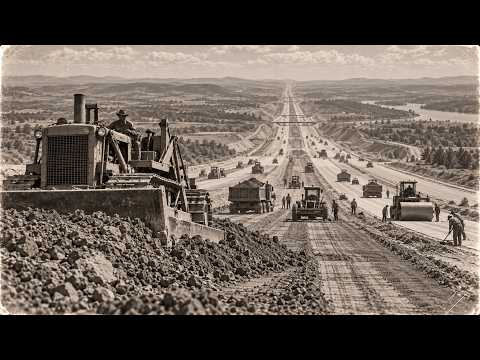
Out on the flat ground of Kansas, meeting those rules mostly came down to moving dirt and pouring concrete. The mountains were a different problem. The old highways over the passes climbed the way a mule climbs, switching back and forth, taking whatever curve the slope would allow. A road built to the new rules couldn’t do that. With loaded trucks at highway speed, it couldn’t turn that tight or climb that steep.
So, wherever a mountain stood in the way, the road would have to go through it.
In 1957, after more than 10 years of pressure from Colorado, the Bureau gave in. It added 547 miles to the system and pushed Interstate 70 west from Denver, across the divide, all the way to a junction with Interstate 15 at a place called Cove Fort, Utah. That fixed the map. It did nothing about the mountains because nobody yet knew where a road built to those rules could get across them.
So, the next governor, Stephen McNichols, hired an engineering firm from New York to go and find out. The firm was E. Lionel Pavlov Engineering, and what its engineers did next sounds simple and isn’t. They took the new rules and laid them across the mountains. Every line a road might follow from the Denver side of the range to the valleys on the far side got drawn out with its grades, its curves, and its price.
They identified seven possible alignments and studied two of them closely. One along the old highway over Berthoud Pass and one along the highway over Loveland Pass toward Vail. The report came back in April of 1960, and its conclusion is the reason the rest of this video exists.
There was no way across the Continental Divide in Colorado on any of those lines without a tunnel.
The engineers recommended the Loveland route with a bore straight through the divide at a place called Straight Creek.
The easiest way I found to picture why comes from the railroads. An old mountain highway is like a hiking trail. It goes wherever the slope lets it, and when the slope gets steep, it just folds back on itself and keeps climbing. A train can’t do that. It can’t take a hairpin, and it can’t climb a wall, which is why railroads go through mountains in tunnels, over valleys on trestles, and through ridges in deep cuts.
The Interstate rules turned a highway into something much closer to a railroad, only four lanes wide and carrying trucks at highway speed. So, wherever the ground argued, the builders had the same short list of answers. They could go over it on bridges and piles. They could cut through it blasting the rock away. They could go under it in a tunnel. Or, where even the ground had to be left alone, they could lift the road off it entirely and build it in the air.
I’m going to show you the hardest version of each one, and the men who had to make it work.
And the mountains had more than one way of saying no. West of Dillon, the planners wanted a shorter line with a second tunnel cutting through a protected wilderness in the Gore Range. That fight ran through most of the 1960s, and in 1968, the federal government refused the easement. The Interstate would go over Vail Pass instead, the long way, which meant exactly the kind of mountain climate its rules had been written to avoid.
In Denver, the men who’d have to build what that report described were already at their desks. Charles Shoemate had gone to work for the State Highway Department in 1924, down in the southwest corner of Colorado. And in 1960, he became its chief engineer. Beside him was a civil engineer named Richard Prosence, who worked up the cost estimates for Interstate 70, and would spend the next 20 years helping decide where it went. Years later, he’d also be the man who picked the engineer for that canyon.
Across the rest of the country, the same rules were turning into road work. Each state highway department drew its own miles and hired its own contractors, and a federal trust fund, filled by taxes on fuel, trucks, and tires, sent the money back. Within weeks of the signing, the State Highway officials and the Bureau had agreed on a single set of design standards, so that a mile in Louisiana and a mile in Colorado would be on paper the same road.
On paper, the ground had other ideas, and it had already made that point to the United States Army the hard way decades earlier.
Washington, July 7th, 1919. A column of 81 Army vehicles lines up to drive to San Francisco. There are heavy trucks, light trucks, motorcycles, ambulances, and a machine shop on wheels. Nobody has ever driven a motorized army convoy across the whole country, and the War Department wants to know whether it can even be done.
The men are 24 officers and 258 enlisted soldiers. And the Army’s own report admits that many of the men in the truck companies were raw recruits with no experience at all. At the first night’s stop in Frederick, Maryland, an observer from the Tank Corps joins them. He’s a lieutenant colonel named Dwight D. Eisenhower, and years later he said he went along partly for a lark and partly to learn.
The man in command was another lieutenant colonel, Charles McClure, and the route took the column out through Maryland and Pennsylvania, and then after Gettysburg, west along the Lincoln Highway, the route that was supposed to tie the two coasts together. It looked like a road on the map, and the column was about to find out what it really was.
The young observer learned fast. The pavement ran out in Illinois, and from there almost all the way through Nevada, the column was on dirt, sand, and mud. Crossing from Council Bluffs, Iowa, into Omaha took 2 hours to cover 5 miles. The machine that mattered most turned out to be a big tractor truck called the Militor, which spent the trip hauling everybody else out of trouble. One night, it rolled into camp towing four broken-down trucks behind it at once.
In western Nebraska, sand swallowed two full days. Bridge after bridge was too weak for the trucks, so the soldiers repaired or rebuilt them on the spot. 14 of them in Wyoming alone. In the whole trip, the column took 6 days of rest at places like North Platte, Nebraska, and Laramie, Wyoming, and the other 56 were spent driving.
The column even carried a keepsake the whole way, a medal of Joan of Arc sent from New York to the Palace of Fine Arts in San Francisco, and people came out to watch. The convoy passed through something like 350 communities, and the estimates of the crowds that turned out along the way run to around 3 million people.
The schedule had planned on an average of 15 miles an hour. On its best stretch, the column touched 32. Across the whole trip, it managed 5.65. That’s about the pace of a man jogging and they held it for 2 months. Think about what that number means for a country that might one day have to move an army in a hurry. The column was only ever as fast as its worst stretch of road and on this trip, there was a worst stretch almost every day.
Those weeks stayed with the young observer and they would shape what he did about American roads decades later.
Then came Utah. At a stop called Ors Ranch, the officer from the Tank Corps wrote down for the War Department what lay ahead. From Ors Ranch to Carson City, Nevada, he reported, “The road was one succession of dust, ruts, pits and holes.” In the same report, he wrote that a very small amount of money spent at the proper time would have kept the road in good condition.
Of everything in that report, that’s the line I’d put on the wall.
The road ahead bore him out. The crossing of the Great Salt Lake Desert was scheduled for 2 days and it took four. Across Nevada, the column was sent over old mining roads between Ely and Austin and that stretch alone cost another day. By the time the trucks reached Carson City, they were days behind schedule with vehicles and men already lost along the way and the Sierra Nevada was still standing between them and the coast.
They got the trucks over the Sierra anyway and on September 6th, the convoy rolled into San Francisco, 62 days after leaving Washington. By the Army’s count, it had covered 3,251 miles. Along the way, it logged 230 road accidents. Nine vehicles never made it to the end and 21 men were hurt badly enough to leave the column.
The War Department’s verdict was blunt: the country’s roads were absolutely incapable of meeting the traffic of the day.
The lieutenant colonel filed his own notes that November and went back to his career. 37 years later as president, he signed the Interstate into law. He’d seen the problem from the seat of a truck, and in 1956, he still had no way of knowing how hard some of the country would fight the answer.
So the swamp got legs, the reef got cut, the divide got a tunnel, and the canyon got a road in the air. The small figures on that deck were finishing a job a stalled convoy had pointed at in 1919.
And the ground they had to beat is the reason it took until 1992.
Which of those four answers would you have bet against the engineers — the swamp, the reef, the divide, or the canyon?
Report this article
Select a reason for reporting: