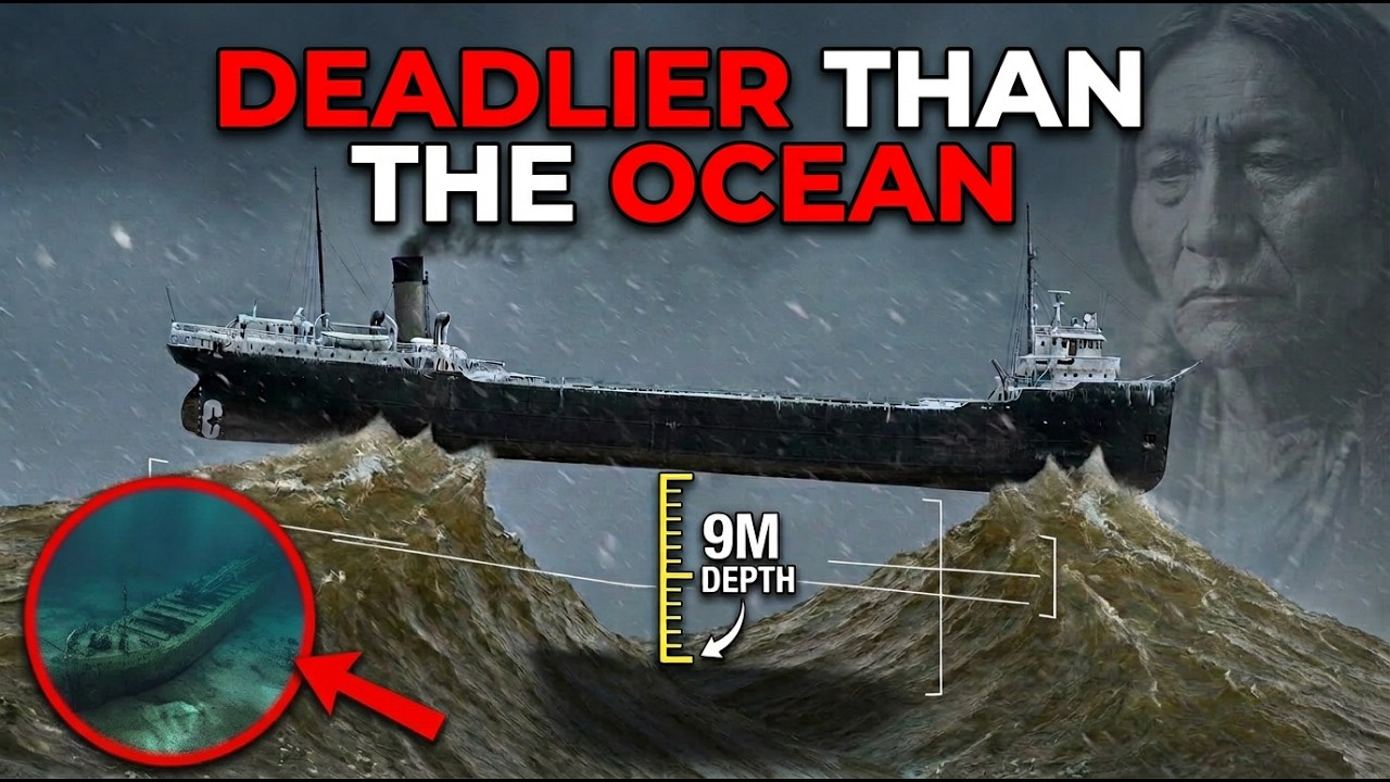
Lake Erie is the shallowest of the Great Lakes, and that single fact shapes nearly everything about how it behaves. Its western basin averages about 24 feet deep, while the open Atlantic averages more than 3,000 meters. When storm waves cannot extend downward, they rise upward, becoming steeper and closer together. For a long ship, this can mean resting on two wave crests with its middle unsupported. More than 1,700 ships have gone down in this lake, according to Ohio Sea Grant, and fewer than 300 have been located.
The people who work these waters often describe them as inland seas rather than lakes. Ocean sailors arriving through the St. Lawrence Seaway frequently find the conditions more demanding than open water. On the ocean, storm waves arrive with long intervals between crests, giving a ship time to climb and recover. On Lake Erie, crests can arrive only seconds apart. Kevin McGee, an engineer at NASA’s Glenn Research Center and co-founder of a shipwreck-hunting group, told NASA’s Earth Observatory that water can be calm one moment and then produce large vertical waves with only a few seconds between them within minutes. Chris Gilchrist, executive director of the National Museum of the Great Lakes, told the Toledo Blade that Lake Erie is probably the most dangerous of all the lakes.
Fresh water also behaves differently from salt water. It is about 2.5 percent less dense, which means a fully loaded ship sits lower in the water. A load line painted on a hull has a separate mark for fresh water so captains know how much less cargo they can safely carry. Fresh water also freezes, and Lake Erie is the only Great Lake that frequently freezes over entirely in winter. Spray that would stay liquid at sea turns to ice on hulls, decks, and wheelhouses, adding weight above the waterline where it is least wanted.
The lake is really three basins in one. The eastern basin averages about 80 feet deep, the central basin about 60 feet, and the western basin about 24 feet. Most of its floor is fine sediment that wind and waves easily disturb. When waves feel the bottom, they change shape. The energy that would spread through deep water has nowhere to go, so the wave slows, shortens, and stands up. On the ocean, this happens only near a beach. On Lake Erie, it happens across the whole lake.
For long freighters, which run from 600 to 1,000 feet, closely spaced waves are a serious problem. The Mariners Museum describes the storm that caught the freighter Carl D. Bradley on Lake Michigan in November 1958 as producing 20-foot seas with crests only 50 to 75 feet apart. A ship that long in waves that short is never floating on a single wave. It can find its bow lifted on one crest and its stern on another while the middle hangs over a trough, a condition called hogging. A moment later, the crest moves underneath the middle, leaving the ends unsupported, a condition called sagging. Steel bent back and forth repeatedly in cold water eventually fails.
The Carl D. Bradley, more than 600 feet long, broke in two in that storm. Thirty-three of the 35 men aboard died. Coast Guard investigators pointed to hogging as a factor, though other explanations were raised and the findings were disputed. Eight years later, on November 29, 1966, the Daniel J. Morrell, 603 feet long, broke in two on Lake Huron in winds exceeding 60 miles per hour. The bow sank, while the stern, with its engine still running, continued for another five miles. Twenty-eight of the 29 men died. The single survivor, a deckhand named Dennis Hale, was rescued from a raft after 38 hours. The final report blamed brittle steel.
Lake Erie has not been documented snapping a freighter of that size in half. But it has the same physics that broke those ships, applied to smaller vessels that were far less able to withstand it. The forecasters who work this lake have acknowledged the difficulty in their own literature. NOAA’s forecasting center reported that its operational Great Lakes wave model performed well on ordinary days but consistently underestimated wave heights during storms.
The danger was demonstrated dramatically in October 1916. On October 18, a hurricane came ashore on the Gulf Coast of Alabama. Two days later, its remnants were over the Great Lakes, no longer a hurricane but still a very strong low-pressure system. For several hours on Friday, October 20, it drove winds of 60 to 75 miles per hour across Lake Erie. Storm warnings had gone up that morning, but some ships sailed anyway.
Shortly after midnight, the James B. Colgate cast off from Buffalo with a cargo of hard coal bound for Fort William at the far end of Lake Superior. She was a whaleback, a 308-foot rounded steel design meant to let waves roll over her. She had survived 24 seasons on the lakes. She headed west up the length of Lake Erie straight into the wind. By evening, water was coming into her hold faster than the pumps could clear it. She took on a list. Around 10:00 that night off Long Point, Ontario, she went down bow first. There were 26 men aboard by the most common count. The captain, Walter Grashaw, was the only survivor. It was his first voyage as master of the ship.
Grashaw went into the water and found a small life raft. Two other men found it as well. The raft flipped in the waves, and they climbed back on. It flipped again. Sometime in the night, one man was swept off and did not return. Hours later, the second engineer let go. Grashaw lashed himself to the raft and drifted. On Saturday, a passenger steamer passed within sight of him, but no one heard his shouts. He was pulled from the lake at dawn on Sunday after roughly 30 hours in the water. The ship that found him was a railroad car ferry called the Marquette and Bessemer No. 2.
The same night, the Marita, a steel bulk freighter of roughly 360 feet loaded with iron ore, was heading east toward Buffalo. She was lost with every man aboard, 23 by some counts, 26 by others. Days later, her wheelhouse was found floating 15 miles south of Port Stanley. Near the mouth of the Detroit River, the wooden lumber carrier Marshall F. Butters went down. Two nearby ships pulled all 13 of her crew out of the water. The D.L. Filer, a 45-year-old schooner hauling coal, sank in the same waters. One man survived, her captain, who clung to the mast through the night and was rescued the following day.
Four ships went down in roughly 18 hours, with around 50 dead by most counts. Sailors named the day Black Friday. Two captains came ashore as the only survivors of their crews. The James B. Colgate was located in 1991 off Erie, Pennsylvania, lying upside down on the lake bed. The D.L. Filer has never been found.
The difficulty in finding these wrecks comes from the lake floor itself. Most of the western basin is fine sediment. Wind and waves stir it up, making the water murky and cloudy. David VanZandt, founder of the Cleveland Underwater Explorers, described it to Ohio magazine as nothing like the clear Atlantic off Florida, but cloudy with sediment and silt and much colder. A wooden ship that goes down in this basin settles into mud. The same storms that sank it keep stirring the floor, and the floor keeps settling over the wreck season after season until the hull is inside it rather than on it.
A wreck buried beneath the mud is invisible to sidescan sonar, which reads the shape of the bottom. A wreck sitting on the bottom throws a shadow. A wreck that has sunk beneath it can look like nothing at all. In 2015, a member of the Cleveland Underwater Explorers named Tom Kowalczk spotted a small target on a sonar screen in Ohio waters. When divers reached it, they found a wooden schooner buried under decades of sediment. It took three years to bring back the resources to investigate it properly. In the summer of 2018, a team spent eight days digging the wreck out of the lake floor.
What they found was almost certainly the Lake Serpent, built in Cleveland in 1821 and lost in the autumn of 1829 while hauling limestone from Put-in-Bay. It is the oldest shipwreck ever identified in Lake Erie, and it had been sitting not far off one of the busiest coastlines in America for 186 years, invisible under the mud. Under Ohio law, nothing can be brought up from these wrecks, so what the mud keeps, the mud keeps.
There is a larger ship out there as well. The first Marquette and Bessemer No. 2, a 338-foot railroad car ferry that vanished in December 1909 with everyone aboard, seven years before her namesake pulled Walter Grashaw out of the water. She has still never been found. Ohio Sea Grant notes that some experts believe she lies in deep water, buried partially or completely in silt, and that every claimed discovery so far has turned out to be something else.
Even when the lake exposes its floor, identification is difficult. In January 2024, a windstorm pushed so much water out of the western basin that the bottom near Toledo was briefly exposed. A local meteorologist posted photographs of a structure lying on the mud with two long cylinders inside it. Within hours, it was being described as a shipwreck with two cannons. Carrie Sowden, director of archaeology at the National Museum of the Great Lakes, went out to look at it. She saw a lot of straight lines, which suggested a pier or dockage rather than a ship. The cylinders, she said, were definitely not cannons.
The same difficulty applies to waves as to wrecks. Lake Erie lies almost exactly along the line of the prevailing wind, 241 miles southwest to northeast from Toledo to Buffalo. The strongest storms that cross it blow from the southwest, so the wind does not just make waves. It pushes the lake itself. Hour after hour, a sustained wind drags surface water toward the northeast end. The level at Toledo drops. The level at Buffalo rises. When the wind quits, all of that displaced water comes sliding back, overshoots, and slides back again.
Scientists call this a seiche. It is exactly what happens when water sloshes in a bathtub, except this tub is 241 miles long and the slosh can be higher than a house. On October 18, 1844, according to NOAA, a seiche 22 feet high came over a 14-foot seawall at Buffalo and killed 78 people. So much ice was driven into the Niagara River that Niagara Falls briefly stopped flowing. The lake is still doing this. In 2008, according to NASA’s Earth Observatory, 16 feet of water rose against Buffalo and flooded parts of the city. In November 2015, a buoy on the eastern end of the lake measured almost the same, and shipping shut down.
In the days before Christmas 2022, a blizzard crossed the lake with winds of 70 to 80 miles per hour. Forecasters expected the water at Buffalo to rise more than 10 feet and the water at Toledo to fall about five. Afterward, the National Weather Service offices in Cleveland and Buffalo reviewed how well their own tools had performed. Their review notes that the official Lake Erie forecast model had assumed the water level could not fall below about one meter down. It fell further. The review’s own words for the model’s picture of the lake floor were that it was not realistic.
The lake has a faster version of this as well. On May 27, 2012, Memorial Day weekend, the south shore of Lake Erie was full of people. That afternoon, two lines of thunderstorms came across the lake from the north. The wind jumped from a breeze to more than 30 miles per hour in a matter of minutes and moved across the shallow lake at close to the speed a wave travels through water that deep. When a squall and a wave travel together at the same speed, the squall feeds the wave. Oceanographers call the result a meteotsunami, a tsunami made by weather.
According to a study published in the Journal of Geophysical Research led by Eric Anderson of NOAA’s Great Lakes Laboratory, the waves that hit the Ohio shore that afternoon reached about seven feet. Near Lakewood, just west of Cleveland, a six-foot wave capsized a boat. The Coast Guard pulled three people from the water. Two and a half hours later and 50 miles east near Madison, Ohio, the water surged up the beach and then pulled back. The retreating water dragged three swimmers over a breakwater and roughly half a mile out into the lake. Recreational boaters got to them. Witnesses along the shore said the same thing. The water went out first. That was the only warning.
The Great Lakes coastal forecasting system, built to predict currents and water levels on these lakes, did not resolve the wave or the storm that caused it. A research report from the University of Michigan’s Cooperative Institute for Great Lakes Research states that plainly. Four years later, a team led by Adam Bechle of Wisconsin Sea Grant went back through two decades of water level records and published the results in Scientific Reports. They found that meteotsunamis large enough to be dangerous, a foot or more, occur about 106 times a year across the Great Lakes, far more often than anyone had thought. Lake Erie, which they describe as by far the shallowest, has the longest season of any of them, from late spring to late fall.
A forecasting and warning system for these waves is still being built. Federal scientists, the weather service, and university researchers have been meeting to design one. Which means that today on Lake Erie, the warning is still the same one those swimmers got in 2012. The water leaves.
The larger pattern is clear. A wave model that underestimated storms. A lake model that could not picture the lake draining. A forecasting system that missed a tsunami. These are not the failures of careless people. They are the failures of tools built for the ocean, aimed at water that does not follow the ocean’s rules.
In 2013, a researcher published a study in the journal PLOS ONE that made this explicit. He took two Lake Erie windstorms and used them to test the standard open-ocean formula for how wind pushes on water. If you model Lake Erie the way you would model the open sea without accounting for its waves, you significantly underestimate how far the water will tilt. By his calculation, waves alone accounted for about a third of the surge. His practical advice to forecasters who could not afford to run a wave model was simple. Take the number the ocean formula gives you and multiply it by roughly 1.5.
More recent modeling work has found that once winds pass about 15 meters per second, each of Lake Erie’s three basins drags on waves differently, and each one needs its own setting in the model. Researchers have gone as far as training machine-learning systems specifically to forecast Lake Erie wave heights because the physics-based models struggle here. The Great Lakes Laboratory cites that work on its own wave forecast page alongside an experimental model built to account for something no ocean forecaster has to think about. Ice.
This is not history. On December 28, 2025, the National Weather Service marine forecast for the eastern end of Lake Erie called for waves of 16 to 21 feet, occasionally approaching 27 feet, on a lake whose average depth is 62. The next day, the forecast office upgraded the gale warning to a storm warning for winds near 50 knots out of the southwest between Geneva-on-the-Lake and Buffalo. The forecasters wrote that waves in the teens would not be unusual for days. The ship stayed in port.
The ocean gives a ship depth, so waves stay long and the hull rides over them. The ocean gives a ship swell, so a storm announces itself hours ahead. The ocean gives a ship salt, so it floats a little higher and freezes a little later. Lake Erie gives none of those things. It gives a floor 24 feet down, waves that stand up seconds apart, a basin that tips when the wind blows, tsunamis without earthquakes, and mud that closes over whatever falls.
The people who study this water still use the word lake because there is no better one. But listen to how they use it. The shallowest of the Great Lakes. The most dangerous of all the lakes. By far the shallowest. Not realistic. Those are their words.
More than 1,700 ships are down there. Two hundred seventy-seven have been found. The rest are in the mud, and the mud is not giving them back. The models, built by careful people with the best instruments available, are still being rewritten around a body of water that keeps doing things the ocean never taught them to expect.






